
 By GRReporter
Title photo: naftemporiki.gr
The traffic on the streets and suburbs of Athens is very slow and difficult. It was stopped for the second time at the crossing of Piraeus and Hamosternas streets because of the huge amount of water. The situation along the seafront is similar, where the cars cannot move to Glyfada.
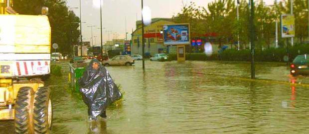
Photo: Facebook
A 10 km long line formed along Athinon Avenue towards Corinth, as well as along the section to Attikon hospital.
So far, the fire brigade has registered about 400 calls from the western suburbs and the neighbourhoods of Egaleo, Haidari, Nikea, Peristeri, Perama. Currently, fire engines are pumping water out of the buildings of the Evelpidon court complex. Power outages have been registered in many neighbourhoods.
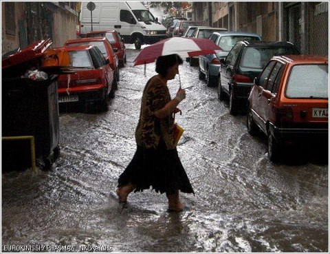
Photo: Eurokinissi / Phasma / G. Nikolaidis
Fire fighters have been helping drivers, who cannot get out of their cars on the flooded roads, namely on Megalou Alexandrou Street in the northern suburb of Stamata, Athinon Avenue and Iera Odos.

Photo: Facebook
The first sailings of flying dolphins to the islands in the Argosaronikos Bay have been interrupted as well as those of small ferries from the port of Rafina to Marmari on Evia Island.
Due to strong winds in the northwest of Crete, the passengers of the evening flight from Athens to Chania had landed at the airport in Heraklion.
According to the weather forecast of the National Meteorological Service, heavy rains are expected in central and northern Greece. Later, the rain will move over the islands in the eastern Aegean and Dodecanese.
Rainstorms in Attica will continue until noon at least and the weather is expected to improve later in the afternoon.
Temperatures will be between 9 and 17 °C, and 2-3 degrees lower in the northern areas.
Heavy clouds and rainfall are expected in the region of Thessaloniki, which will begin to subside in the afternoon. The temperature in the city is between 6 and 10 °C.
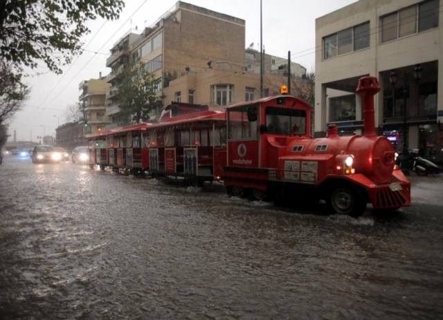
Photo: ethnos.gr
At 10:20 am, the National Meteorological Service made an extraordinary weather forecast and informed of worsening weather conditions. The text reads:
"Torrential rains and storms in the regions of Attica, Euboea and the islands in the central and northern part of the Aegean Sea will continue in the coming hours. They are expected to reach the areas east of Thessaly and Central Macedonia.
The weather in the region of Athens will start changing after 1:00 pm and in the evening in other regions. "
An "explosive" combination of atmospheric transfers of masses of desert dust from Africa and the low barometric pressure over the region of Attica was the cause of the unprecedented thunderstorm in Athens as stated by experts.
According to weathermen, the volume of rain that poured over Attica between 5 am and 11 am exceeded 95 mm. They argue that there was no such amount of rain over the past 10 years. For comparison, the average amount in February between 1961 and 1990 was 48.3 mm.
http://gogreece.about.com/gi/o.htm?zi=1/XJ&zTi=1&sdn=gogreece&cdn=travel&tm=6&f=22&tt=2&bt=0&bts=0&zu=http%3A//www.grreporter.info/en/
No comments:
Post a Comment